Sunday, March 27, 2011

CHAPTER.10- THE SOUTHERN COASTLANDS

Some of the largest ports in the United States are located in the southern coastlands. As evident from our reading, these ports have been hugely important in the development of this region of the United States. the port of Los Angeles, is also very important, and along with the port of Long Beach in a huge contributor to our local economy. The port opened in December 1907 and in 2005 was the busiest container port in the United States. The port complex covers an area of 7,500 acres, with a harbor covering 3,300 acres. Over 16,000 people are employed by the harbor, impacting out local economy, as well as our local politics, infrastructure, and way of life.  Cruise ships also dock at Los Angeles harbor, including the famous Queen Mary 2, which is the largest cruise ship to ever sail from Los Angeles. The port have passenger traffic of over 1 million people annually, including tourist who contribute to our economy by patronizing local businesses and attractions.
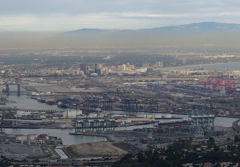
File:LA-port+Long-Beach1.jpg
L.A Port
Photograph source: http://en.wikipedia.org/wiki/File:LA-port%2BLong-Beach1.jpg

Saturday, March 19, 2011

CH.9- THE CHANGING SOUTH

There are some dark periods in the history of the south, plagued with prejudice and segregation of African Americans. Los Angeles is no stranger to these attributes. In 1965, the Watts Riots, which lasted 6 days and claimed the life of 34 people while injuring over 1,000 others, was viewed by many as a reaction to the racial injustices suffered by African Americans in the L.A area through police brutality, as well as job and housing discrimination.
 SOURCE: http://www.negroartist.com/WATTS%20RIOTS/slides/A%20montage%20of%20pictures%20of%20the%20Watts%20riots%20in%20Los%20Angeles,%20August%2011%2015,%201965.jpg

This photograph depicts some of the looting and destruction caused by the 6 days of riots, resulting in over $40 million of damage.

Wednesday, March 16, 2011

CHAPTER.8- APPALACHIA AND THE OZARKS

This chapter went into great deal about the topography of this region of the United States. Los Angeles's topography s very different, but still as interesting. The Los Angeles area covers nearly 500 square miles, with 470 square miles of land, and 30 square miles of water. The highest point is Mount Lukens, which reaches 5080 feet and is in the northeast part of the San Fernando Valley area of L.A. The majority of Los Angeles lies on a hilly coastal plain with the Pacific Ocean to the south and west.


source:  http://www.theregister.co.uk/2009/06/30/nasa_japan_release_99_complete_topographic_map/

Tuesday, March 15, 2011

CHAPTER.7- THE BYPASSED EAST

After reading about the importance of agriculture in the bypassed east, I decided to do some research on agriculture in the Los Angeles area. While Los Angeles is mainly an urbanized area, there is a significant amount of agriculture produced in our county! The Antelope Valley is one part of the country which has a significant amount of agriculture. Crops produced include: alfalfa, carrots, potatoes, peaches, grapes and nectarines, according to the University of California Agriculture and Natural Resources website. In L.A county, over $250,000,0000 of crops are produced each year. Agriculture is also significant in our surrounding areas, such as Ventura County, which takes advantage of our southern California climate. All of the local produce grown is why there are so many farmers markets in Los Angeles, enabling us to talk one on one with the people who grow our food, while saving money and resources by cutting down on transportation costs and resources. 
 Source: http://celosangeles.ucdavis.edu/Agriculture/